In today’s data-driven world, businesses are increasingly recognizing the value of location-based insights. Geo-locating data within Microsoft Dynamics CRM can significantly enhance decision-making processes and improve customer engagement strategies. This blog post explores the benefits, methods, and tools for geo-locating Dynamics CRM data to derive more accurate insights.
Understanding Geo-location in Dynamics CRM
What is Geo-location?
Geo-location refers to the identification of the real-world geographic location of an object, such as a person or a business, using various technologies. In the context of Dynamics CRM, geo-location involves extracting geographic coordinates (latitude and longitude) from address data stored in the CRM system. This allows businesses to visualize their data on maps, making it easier to analyze trends and patterns based on location.
Why is Geo-location Important?
The integration of geo-location with CRM data provides several advantages:
- Enhanced Decision Making: By visualizing customer locations, businesses can make informed decisions about resource allocation, sales strategies, and marketing campaigns.
- Improved Customer Targeting: Understanding where customers are located allows for more personalized marketing efforts and better service delivery.
- Operational Efficiency: Geo-locating data can streamline logistics and route planning, reducing costs and improving service times.
Benefits of Geo-locating Dynamics CRM Data
Visual Insights:
- Mapping customer data enables businesses to see geographic trends that might not be apparent in traditional reports. For instance, sales teams can identify regions with high demand or areas that require more attention.
Market Analysis:
- Businesses can conduct regional analyses to understand market dynamics better. By plotting data on a map, companies can assess market saturation and identify opportunities for expansion.
Enhanced Customer Engagement:
- By leveraging geo-location data, businesses can tailor their communications and offers based on local preferences and behaviors, leading to higher engagement rates.
Strategic Planning:
- Companies can use geo-located data to inform strategic decisions such as site selection for new stores or offices based on customer density and demographics.
How to Geo-locate Dynamics CRM Data

1. Geocoding Basics
Geocoding is the process of converting addresses into geographic coordinates. In Dynamics CRM, this can be achieved through various tools and methods:
- Manual Geocoding: Entering addresses into mapping software individually.
- Batch Geocoding: Using tools that allow bulk processing of addresses to generate coordinates automatically.
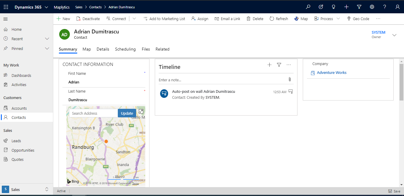
2. Utilizing Maplytics for Integration
Maplytics is a powerful tool that integrates Microsoft Dynamics 365 CRM with Bing Maps. It allows users to:
- Automatically geocode CRM records.
- Visualize data on maps as pushpins based on their geographic coordinates.
- Analyze key performance indicators (KPIs) related to location.
With Maplytics, organizations can perform tasks such as:
- Identifying nearby customers or leads.
- Creating optimized routes for field sales teams.
- Conducting territory management by visualizing sales regions on maps.
Readmore : the future of sales ai automation in dynamics 365 crm
Implementing Geo-location Strategies
1. Identify Key Data Points
To effectively geo-locate your CRM data, start by identifying which records contain relevant address information. Common entities include:
- Accounts
- Contacts
- Leads
2. Set Up Geocoding Workflows
Implement workflows within Dynamics 365 that automatically geocode records upon creation or modification of address fields. This ensures that your data remains current and accurate without manual intervention.
3. Leverage Location-Based Insights
Once your data is geo-coded, utilize it in your business strategies:
- Create targeted marketing campaigns based on geographic segments.
- Analyze sales performance by region to identify strengths and weaknesses.
- Optimize logistics and delivery routes using real-time map data.
Best Practices for Geo-locating Data
Regularly Update Your Data:
- Ensure that your address records are up-to-date to maintain accuracy in geolocation efforts.
Use Quality Mapping Tools:
- Invest in reliable mapping solutions like Maplytics that offer seamless integration with Dynamics 365 and provide robust geolocation capabilities.
Train Your Team:
- Educate your staff on how to leverage geo-located data effectively in their daily operations.
Conclusion
Geo-locating Dynamics CRM data is not just a trend; it is a necessity for businesses looking to gain deeper insights into their operations and customer base. By employing effective geocoding techniques and utilizing powerful tools like Maplytics, organizations can enhance their decision-making processes, improve customer engagement, and ultimately drive growth.
For businesses seeking expert assistance in implementing these strategies, SkySoft Connections Services offers comprehensive solutions tailored to your needs. Our team specializes in integrating geo-location capabilities into your existing systems, ensuring you harness the full potential of your CRM data for better insights and outcomes.
Readmore : enhancing data visualization with charts in power apps
FAQ’s
Geo-location in Dynamics CRM refers to the process of identifying the geographic coordinates (latitude and longitude) of customer addresses stored in the CRM system. It is important because it allows businesses to visualize data on maps, enabling better decision-making, improved customer targeting, and enhanced operational efficiency. By understanding customer locations, companies can tailor their marketing strategies and optimize resource allocation.
To geo-locate your Dynamics CRM data, you can use geocoding methods such as:
Manual Geocoding: Inputting addresses into mapping software individually.
Batch Geocoding: Using tools that process multiple addresses automatically.
Integrating tools like Maplytics with Dynamics 365 can streamline this process by automatically geocoding records and visualizing them on maps.
Using geo-location for your business offers several benefits, including:
Enhanced Visual Insights: Identify geographic trends that inform strategic decisions.
Improved Customer Engagement: Tailor marketing efforts based on local preferences.
Operational Efficiency: Optimize logistics and route planning to reduce costs.
By leveraging these insights, businesses can make data-driven decisions that lead to increased growth and customer satisfaction.
![]() is a software solution company that was established in 2016. Our quality services begin with experience and end with dedication. Our directors have more than 15 years of IT experience to handle various projects successfully. Our dedicated teams are available to help our clients streamline their business processes, enhance their customer support, automate their day-to-day tasks, and provide software solutions tailored to their specific needs. We are experts in Dynamics 365 and Power Platform services, whether you need Dynamics 365 implementation, customization, integration, data migration, training, or ongoing support.
is a software solution company that was established in 2016. Our quality services begin with experience and end with dedication. Our directors have more than 15 years of IT experience to handle various projects successfully. Our dedicated teams are available to help our clients streamline their business processes, enhance their customer support, automate their day-to-day tasks, and provide software solutions tailored to their specific needs. We are experts in Dynamics 365 and Power Platform services, whether you need Dynamics 365 implementation, customization, integration, data migration, training, or ongoing support.